Sunday, July 17, 2011

Gunung Rinjani of Lombok

Gunung Rinjani
The 3rd highest mountain in Indonesia at 3,726 m, is also one of the toughest mountain to be climbed.  Located on the island of Pulau Mutiara (translated to means Pearl Island, for this island is also famous for pearls), it is commonly known as Lombok both locally as well as globally.  Separated by a straits from the more famous island of Bali,  this is an Island, which is a good alternative to the bustling island of Bali for vacation, not as cosmopolitan but definitely still preserves all the charm of a rustic with spartan lifestyle. 

Gunung Rinjani itself is at the north of the island, and the bustling activities tends to be located as far away from this live volcano, which will be in the west and south.  The island by the Indonesian archipelago standard is not big, and is dominated by this big lively volcano that can be seen from any part of this island with an unobstructed view.

Gunung Rinjani which is an active volcano that last erupted about a year ago.  It so happened I was on this very mountain when it was spewing lava in July 2009, that I stood at the rim of this volcano witnessing the magmatic event, then we were not allowed to climb to the summit nor go down to the crater lake as the volcano was rumbling and whistling like a runaway steam locomotive with the escaped steam. This year (2011) it was different, this volcano is at peace within itself; just some steam spewing out from its vents, and one has to look very closely to notice these plumes.
Gunung Rinjani (July 2009)  the centre black streak - that was caused by the lava flow.

Gunung Rinjani (July 2011) - the volcano is at peace
To climb to the rim, there are typically two routes, the easier one which we did in 2009 was to start and end via the Senaru Village, or the harder route which is by Sembalun Lawang. We chose the harder route for our climb, and did a crossover to the Senaru Village.  For doing a crossover, this would entail the fact that you had to bring all your gears with you in your trekking.

Climbing Profile of the track.  The "valley" is the crater, where we have decended, and again the upward climb to the rim before heading down to Senaru Village.
We arrived at Lombok international airport at Mataram, and were driven for hours to the Sembalun Lawang Lodge. By the time we arrived, it was almost midnight, this location is about 1200 m above sea level, and is surprisingly chilly!
One thing I have noticed about Rinjani, is that the weather is like the desert, hot in the daytime, and cold at night. This very night, the temperature dipped below 10 deg C.  Though we had a long day, very few of us were in the mood for shower, after all there were no hot water in the rooms, and worse some of us had no water at all!  We retired quickly for the night, as the trekking began at 5 am, as we need to reach the campsite at the rim early so as to secure a good location, for good space is limited.

Day 1 (Sembalun Lawang to Plawangan 2)
Having to start off at 5 am, and with a few winks of sleep, we were thankful that this was the beginning of the climb which is less dangerous, after all our alertness had been compromised by tiredness and lack of sleep; and one false steps can lead to the abandonment of the climb.

The journey to this campsite is most scenic, as the path crosses many interesting points.
We walked in path with long grasses; crossed bridge over gully; seen the effect of the hot weather as we saw many dried riverbed; and most majestic will be the views of the volcano itself.
Day 1 - still at the foot of the volcano, but we were already 1,100 m high.  Walking through long grasses, despite the seemingly hot sensation, it was still quite cold in this early hour.
Another shot of the journey through the long grass track. (Picture courtesy of Loh CH)
Walking across dried up river bed. (Picture courtesy of Loh CH)


The beautiful scenery of valley and gorge. (Picture courtesy of Loh CH)
The second part of this day journey is an incessant long climb up. Incessant as in having round one corner, one is faced with another round of climbing, and this would go on for hours as the path will zigzag up the volcano slope till finally one reaches flat ground, and that would also be the rim of the volcano, with one side leading to the crater, and the other side the foot of the volcano.

By the time, we reached the rim, and the campsite at Plawangan 2 (2,639 m), we were so glad that the tents had been set up, and all we have to do was to plonk ourselves into the tent. But, the view here and at this hour of twilight was most fantastic. As the sun began to set, the particles in the air caused the sunlight to split from its pure form to produce the beautiful array of multiple hue of the light spectrum to give us this magnificent of dusk.
Day 1 Campsite.  Though we may have started early on this day, there were many people having the same idea, and we were not the first on the rim. (picture courtesy of Loh CH)

After the last light, and the campsite was enveloped in veil of darkness, and then one lifted one's eyes to heaven, the heaven was speckled with dots of light and more amazingly the river of stars (milky way).  We were witnessing our home in space, as the solar system joins the myriads of stars in our galaxy.
The sun may have set, but we were still having some of the remnants of the sun light.  As can be seen, at this altitude, we were above the cloud.
Finally the last light, and the moon can be seen at the top.  (This is the exact colour, picture has not been edited)
Before we retired for the evening in the unusual time of 8 pm, we were told that we would be setting off at 1:30 in the morning to catch the sunrise on the summit. This meant that we were going to have a long climb ahead of us! 

Day 2 (Plawangan 2 to Summit, and then back to Plawangan 2 to Lake Segara)
We awoke with stiff muscles and back, as we had been sleeping on gravels, which is the primary substrate covering a live volcano.

Once again the climb of the previous day was to be repeated, except that the intensity had increased, as the slope is covered with loose gravels and every steps on the gravels cause one to slip!  Thus the saying of for every 3 steps, you slip 2 steps.  At this juncture of the climb, it was more of 3 steps with 1 slippage!  Still in such environment, one's muscle must be strong for climbing on such terrain, as the ground shifts under our weight.
Initial Climb in the middle of the night.  It was cold, and we were sored, but we were determined.
(Picture courtesy of Loh CH)
Final push to the summit.  At this time, the sun was breaking out from the horizon. (Picture courtesy of Loh CH)
Proceeding to climb, this part of the trek is made up of 3 parts.  The first part is a steep climb, and subsequently a comforting flat terrain to be followed by the final summit assault which is most demanding with steep slop.  On this final slope to the 3,726 m summit, the paths are covered with loose gravels and this time the effect of 3 steps up and 2 steps slippage became a reality. But like most loose substrate, the trick of climbing with minimal slippage is to do it fast, just like walking in the swamp, the moment one stops, one will start to sink, and this is the same with such loose gravels, sinking is equivalent to slippage as one is also on a slope of acute angle (estimated to be between 45 deg to 60 deg),

Having strived, panted and possibly cursing under our breath, we arrived at the summit.  At this vantage point, we were presented with a beautiful view of the island of Lombok of which this volcano sits.  And even the neighbouring Bali highest peak, Gunung Agung can be seen.
A clearer view of the terrain as we pushed for the summit.  Notice the loose earth and rocks.  (Picture courtesy of Loh CH)
The unexpected highlight of the day was the surprise move of the proposal of a man to his beloved, at 3,726 m up and surrounded by clouds, this occasion, a rarity and most endearing to us who witnessed it.  We wish the happy couple - Blessed Togetherness in the near further.

Congratulations and Best Wishes to this Happy Couple
After enjoying the view on the summit, the descent was most challenging, tiredness compounded with the unstable substrate assured a few falls for most of us.  But we got the hang of it, by doing a dig, heel and slide motion.  Digging into the gravels with the heel, and leaning backward as we slid downward, and thus saving energy in the process, to be repeated once the sliding stopped.  Sliding has a downside and that is it is harder to control the direction of descent, and one would like to control the direction if the ridge is only about 1 to 1.5 m across. As it would be the crater or the foot of the volcano, a nasty slide of about 1,000 m on either sides. Not a comforting thought!
Observe that our foot sunk into the earth. (Picture courtesy of Loh CH)

Downward trek to our camp at the rim.  At this point, the crater that we have passed during the night became obvious.
In the crater, rise another "hill", this is where the real activity of the volcano takes place. The local called this Gunung Anak Baru (the young/child mountain).
We managed to return to our campsite, and had our brunch before making another arduous descent to the crater (Senaru Lake). Today, the journey will be longer than the previous day, as we had to combine both the summit ascent as well as this descent.
Walking down towards the crater.  Honestly, it was much harder going down than going up! (Picture courtesy of Loh CH)
Arriving at a good time, we enjoyed ourselves by the lake.  In as much as the water was warm and inviting, we were hesitant to go into the water for it was polluted with rubbish that has been carelessly discarded.  The pollutants came in many forms, and the description is best left to the imagination of the readers.  However, along the shoreline, there were many avid fishermen, hoping to land themselves a carp or two!

Day 3 (Lake Segara to Pos 2)
Waking up at the normal hour unlike the last 2 days, we had to ascend from the lake and up to the rim to our next campsite. Once again, it was an incessant climb up, but definitely not as bad as the journey to the summit, or the journey down.

The beginning of this journey was most challenging, as we had to negotiate narrow walkway around the lake, holding onto roots and branches for support. As we struggled to maneuver these obstacles, the porters with their heavy load were making us looked bad as they skillfully and agilely negotiated every turns without even using their hands.  Must be the poles they used for balancing!
Negotiating the narrow walkway around the lake. (Picture courtesy of Loh CH)
Having given the choice of camping at Plawangan 1 or Pos 2, we decided to choose a longer journey to Pos 2 (1,500 m) for today, as it is located at a lower altitude which provides a more hospitable environment of milder climate.  Plawangan 1 (at 2,641 m) is still at the rim, and we realised that it will be cold and may be plagued with water problem.
The ultimate reason for us, is that the following day, we would have a shorter walk to Senaru village, which would be the end of this trek.
The difficult climb began after we circumvent the lake. (Picture courtesy of Loh CH)

But we were rewarded with the majestic view surrounding us.

And still we have to climb some more before we reached the rim. (Picture courtesy of Loh CH)
Day 4 (Pos 2 to Senaru Village)
Final day of trekking, we walked from Pos 2 to our lodge in Senaru Village.
But before the start of our trek, we thanked our porters, guides, and cooks for making this trip possible.  After all, we were carrying our daypacks which only weighed between 5 to 12 kg, but the porters were easily handling loads of between 25 to 40 kg easily, and they still managed to walk faster than us.
Porters with the heavy load. (Picture courtesy of Loh CH)
Summary
As we reflected on this climb, most of us who had climbed various mountains, mountains that are higher than Rinjani have to admit that this is one tough mountain. On the other hand, we felt a certain triumph of being able to reach the summit.  Many had harboured thoughts of giving up as the ways were tough, but for those who made it to the summit, there were much psyching of our mind over body, and possessing the ever pressing on attitude to reach the goal.
Such is our determination, and on further thoughts, we will be using this same determination with God's grace to overcome whatever challenges in any of our endeavours.  

Acknowledgement
A special thanks to Lois for proof reading my draft.
And a big thank you to Loh CH, my colleague and fellow climber for sharing the pictues.

Tuesday, February 22, 2011

Agaricus Mushroom in Bukit Timah

Why oh why are mushrooms so hard to ID!
Coming down from my trekking, near to the beginning of the Summit Trial, one can find 2 logs, and on a good damp day, it will be covered with mushrooms.

Today is no exception, I find it intriguing that one log was covered with these white fungus, and somehow the other log was pretty much spared.

Taking some close up, I believe these are the Lepiota (sp), or commonly called the Parasol Mushroom.
(somehow I can hear some giggling over this name, isn't it obvious that mushrooms usually look like parasol. Good Question which I have no answer)

So these are some of the close-ups of this species.
From the pictures, one can see the various stages of development.
With the young mushrooms with undeveloped caps just emerging from the log, to the fully bloom mature adults.


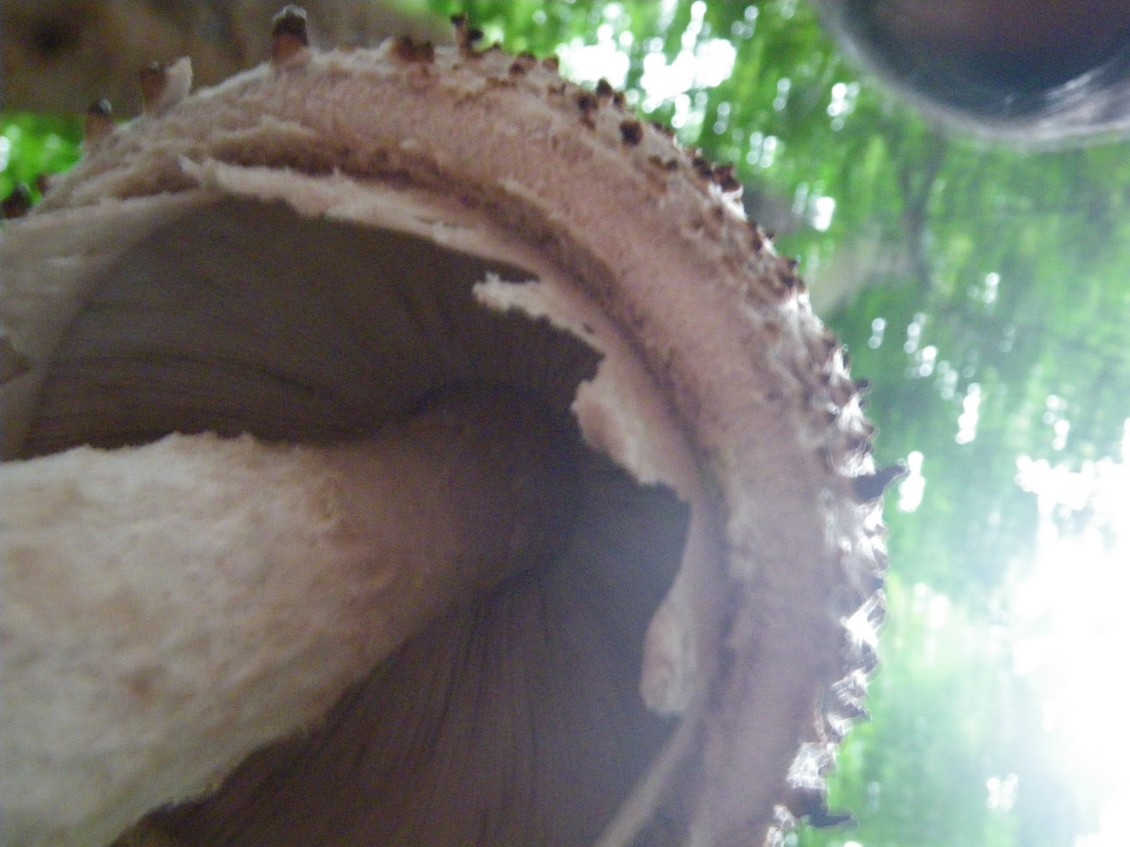
The cap of this species is rather thin, that the gills from the underside can be seen.
The stipe itself is relatively thin, with the annulus forming at midpoint.
I thought this could be a Marasmius, but then the stipe is quite long!
Or a Hygrophorus, but then the stipe is too thin!
So my conclusion that this is probably a Leipiota.


Taken from underneath, the annulus on the right specimen is pretty obvious, and the evidence of the thin cap to produce this highlighted shot.


A side view of this same specimen.

Alas, from experience, these mushrooms will disappear in about a week time, leaving behind brownish patches, and nutrients for the next generation to sprout!

Thursday, February 10, 2011

Another Giant Agaricus in Bukit Timah

Where there is dead log and plenty of moisture, one is guaranteed to see fungi.
Today, having finished my climb in Bt Timah, and returning to the Dairy Farm Car Park, I chanced upon this Giant Agaricus in the male toilet.

From initial observation,

  • it has a rather deep depression in the centre where the stipe (stem) is located 
  • the cap is very unusual, in that it flows down like a skirt
  • the stipe is very short for such a big pileus (cap)

Again, I tried to ID this specimen, and the only conclusion I have is that it is a gilled mushroom of the Agaricales Order.
Initial ID seems to place this in the family of the Brittle Cap, but those have long stipes, whereas this does not!

Does this specimen belongs to the Brittle Cap family?  To me, it is more like a bottle cap!

Placing a ruler, the cap spread across almost 13 cm!

Taking the underside, shows that the gills reach to the end of the cap.


Naturally, how does one justify a 13 cm size specimen to be a giant, well I looked around and saw couple of the same species growing around, and the spread of the cap was about 5 cam.

Two specimens here, with one already badly damaged.  Otherwise, the cap spread is about 5 cm.

 Once again, if anybody can ID this species, please do let me know.

Tuesday, December 28, 2010

Gigantic Agaricus Mushroom

In Bukit Timah Nature Reserve, it is very easy for anyone to see fungi of many shapes, colours and sizes. However, on one such walk, I came across this huge mushroom.
How big? See my handphone which I have placed next to the stipe (stem)!

As I tried to dig further into its ID, I believe that this is most probably from Agaricus sp, as the underside shows the gill.


Another picture of this huge one without the phone to spoil the shot.


 To those who are familiar with Bukit Timah Nature Reserve, look at the background - can you see the road!


TWO Days Later
I went to look for this specimen again, hoping to take better picture with flash now that I have freshly charged the battery.

This specimen has started to spread its cap.

Though there is a little budge in the centre of the stipe, othrewise it is pretty constant in the diameter! 


The scales are found more towards the edges

The Gills as can be seen is not white, tends towards the brownish blackish side.


I have a strong hunch that this could be Amanita sculpta as in other literature, it was mentioned that this species can grow very large.

FOUR Days Later
Went trekking again, and once again I was monitoring on the progress of this specimen.

Between Day 2 and 4, there has not been much changes to this specimen.
SIX Days Later
I went back to check on this specimen, alas - only part of the stem was left.


From the look of it, it did not wither but rather it fell into some form of mischief from the foot of someone.
I hunt around for the cap, and was not able to find it.
Hoping that the spores would have spread somewhere, and soon another of this giant can be found.

If anyone who view this blog knows the ID of this Agaricus, appreciate if you can drop me a note.
Thanks

Wednesday, November 3, 2010

Sagar Matha - The Head with a White Crown

Sagar Matha National Park

To the Nepalese, the highest mountain stands at 8,848 m is Sagar Matha, and to the Tibetan it is called Chomolunga, but to the world it is known as Everest.  Named after a British Sir George Everest.

We have planned this trip for almost a year, and we have chosen October period as this is the best time of the year to attempt to climb to Everest Base Camp.  Our journey will end here, but to those that proceed to the Everest Summit, this is just their starting point!
Having cover this journey in that many days, feeling exhausted and only up to 5,600 m, I can but have the deepest respect for these people that have attempted and will attempt the Everest Summit.  Along the way, we saw many stupas, some build in remembrance of conquest, but many in remembrance of fallen heroes that somehow perished in their quest to reach the roof of the world!

Day 1 – Kathmandu (average 1,300 m) to Lukla (2,858 m) to Phakding (2,636 m)
The airport at Lukla also known as Tenzing-Hillary Airport is one of the world top 10 Extreme Airport.  Known for its short runway, situated on a slope and  foggy weather.

Journey to some of the highest mountain on earth, requires one to land in this airport.  And this we did, with turbo-prop planes from Kathmandu.

The video below will give you a good idea on this airport.  Many years ago, I read in one of the scientific magazine where they were contemplating on slope leading to the airport terminal.  The slope will assist in slowing the plane down thus saving fuel, and at the same time assist in taking off when the plan rolls away from the terminal.  Well Lukla airport is “designed” in such manner.
Tenzing Hillary Airport at Lukla but commonly known as Lukla Airport


The start of our journey at Lukla located at 2858 m above sea level.  A quick stop for lunch, and we were off to Phakding.  The profile of our journey can be seen, and it is downslope to 2636 m.  Naturally, behind most of our mind was the fact that on our return journey we have to make this 220 m climb to Lukla!

Lukla is the starting point for most of the scenic routes in Nepal, and is also one of the bottleneck in all the traveller's itinerary!  There is only one quick way in and out, and it is through this airport.  Ever since the Maoist rebel has dropped their arms and became part of the government, the tourist industry has picked up, and making Lukla a very busy place.
Our chief guide, we learnt has to spend 3 years in Malaysia to work during this turmoil period.  He was thankful to be back to his homeland and bringing city folks like us to view his beloved country.

School Children going to school.  Very interesting uniform.

The team at the beginning of the trek at Lukla
At 2,800m,  there is still farm
At this low altitude, trees grow in abundance, and are tall
Little local - innocent and happy

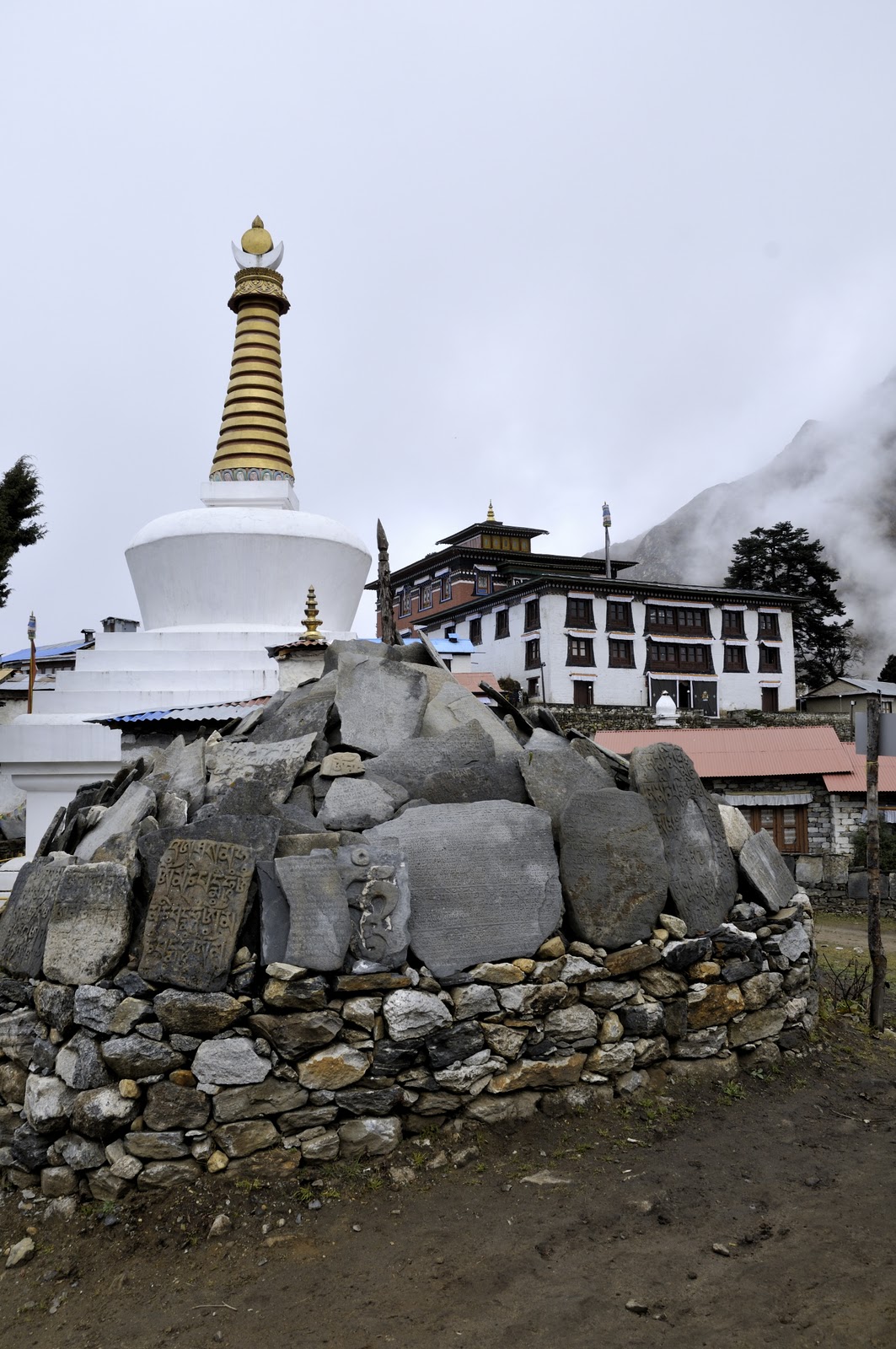
Slates with carving (probably of prayer)

Throughout the journey, one will see many prayers engraved or painted on rocks and walls.
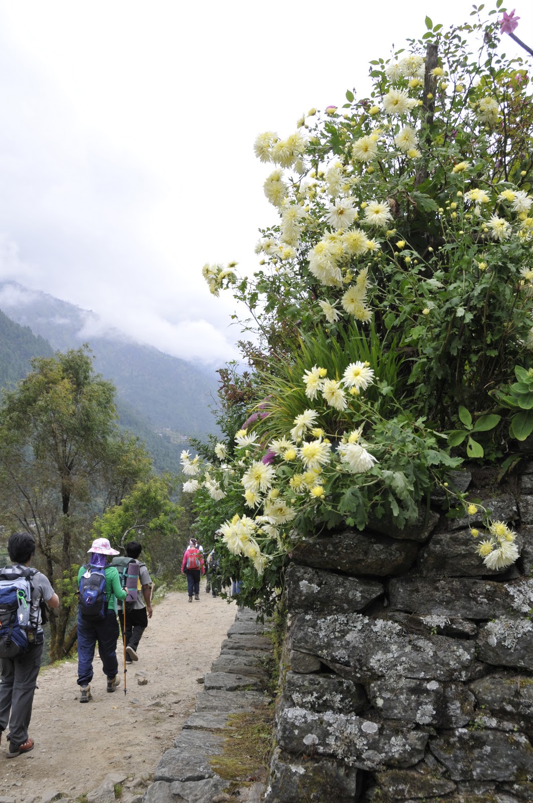
Flowers grow in abundance despite the fact that it is Autumn!

One of the many suspension bridges that we have to cross

Suspension Bridge in Phakding, spanning the Kosi River


Dudh Kosi (Kosi River) in Phakding (taken from the suspension bridge)

Day 2 – Phakding to Namche Bazar (3,517 m)
We awoke to a beautiful morning, the ray from the sun just strike the mountain in front of our camp site, and to the early birds we were rewarded with this majesty view.

The reality of "Opening the Door to see the Mountain" - that was our reward on this morning.
Our daily routine was standard, waking up at 5:30 am, breakfast at 7 am and onward trekking at 8 am.  For me it was 5:30 am as we retired early the night before.  After all, what is one going to do after the last light and long walk, sleep.
The start of our climb from Phakding
Green vegetables grow very well in this altitude.  In fact such will be our staple for the next 14 days!  This is either cabbage or Cauliflower, both of which we have in abundance on our dining table!

A beautiful abode in the valley

There were many young ones along the way, are they deprived? Definitely not, they are not under nourished, in fact they look healthy and fit!


Again, young healthy children. 

Along the trek, when the treeline breaks, the majestic mountain is reviewed. This is Ama Dablam at 6,812 m.


We criss-crossed the Kosi River in many points, at least 5 suspension bridges from Phakding to Namche.


One of the most grueling climb in this 14 days journey, thankfully the attitude is below 4,000 m, and breathing is still easy.  From the climbing profile, the last 3 linear kilometer was most tough!  Very little respite, as it was climb and more climb.

The beginning of the grueling climb offered us a majestic view of the last suspension bridge we were about to cross.


The final Suspension Bridge but a long way up to Namche.

The beginning of our Climb!

The Suspension Bridge up close.
The view from the bridge
Arrival at Namche Bazar, and how do you know?  Because you have just arrive at a market. (Bazaar)


Day 3 –  Namche Bazar (Acclimitization)
Drawn from our Kilimanjaro experience, we have to allow our body to get use to the high altitude, and we rest one day here.
Awaken to a misty morning, but a break in the fog and cloud to review the mountain peak from our camp site.


Namche Town as viewed from our camp site.

By 9 in the morning, when the mist was just lifted - the mountains surrounding Namche were reviewed.

Group Photo of the members.  After breakfast and before shopping! Not too sure why they are crouching in this manner, it was not that cold!
Namche Bazar (bazaar), the place where merchants bring their goods from across the country, especially from Tibet to sell their goods.  For us, it was a good opportunity to see the tribal folks coming together to buy and sell.
The many steps of our journey.

Pot and pan, just about anything can be purchased here. 


Shopper Traps!

A Night Shot of Namche (Picture courtesy of Rainbow Chen)

Day 4 – Namche Bazar to Tengboche (3,858 m)

After the grueling climb, it was off to Tengboche.  On this day, we were granted a fantastic view of Sagar Matha (Everest).  The mist was coming over fast, most of us were fortunate to catch the glimpses of the highest peak, but not all were fast enough to capture as image.

Leaving Namche
We finally got to see Mt Everest.  The first snow peak on the left.  Ama Dablam is partially hidden on the right.
Mt Everest
Another View (from left to Right) - Mt Everest, Lhotse (8,500 m) and then Ama Dablam
A few seconds later, the mist was rolling over the mountain range, and soon shrouded it from our sight.
And the mist rolled in to shroud the mountains from our view!
Chorten in commendation of the Sherpas (the Tigers of the Snow)
Plaque on the Chorten
There will be many more steps in our journey!  But the views are worth are fantastic.

The Local.
As it was October, the Autumn Colurs can be seen in the non-deciduous trees.
We arrived at Tengboche, where a huge monastery reside.
Arriving at Tengboche, the place was shrouded in mist.  Our arrival in the foggy plain.


A summary of our climb from Namche to Tengboche.


Day 5 – Tengboche to Phariche (4,263 m)
In the wee hour of the morning, the morning will be chanting and blowing the horn, awakening those who still were asleep in their tents.  Save those with ear plugs on, that required a good shake to ward off the sleepiness.

Again this morning, the Tengboche Plain was shrouded in mist.

Mist Covered Mountain
The journey to Pheriche was an exciting one, as the path was flanked by autumn colours.

Trees started to get scarce, and moss and lichen starts to dominate at this altitude.

Stone Fence

Khumbu River as we near Pheriche
Many stupas dot our trail.

Phariche - One of the few places along our route that has a Medical Centre.  Once again, we have to allow our body to acclimatize to this high altitude.  Phariche is extremely windy, and chill factor bring the temperature down to sub-zero at night.

Onward journey towards Pheriche.  The majestic Ama Dablam is on the right, and Everest is not hidden on the left.

Ama Dablam
Another stream, and we saw this local doing his laundry.  Behind him is a hut for a prayer wheel power by the stream.

You can never get tired of the view!

The last bridge to cross for the day.  Bridge over River Khumbu.
Main Street of Pheriche
Our campsite, orange tents are the sleeping quarters, and the green is the dining tent.
The nice thing about Phariche is that River Khumbu runs parallel to this little town, and the scenery was most fantastic.

Day 6 – Phariche (Acclimatization)
We spent this day at the brook (River Khumbu), and attend talks on mountain sickness.  It was a good reminder for all of us, as mountain sickness can strike anyone of us who is foolish to move faster than the body can adapt.  Recommendation is to ascend 400m per day to let the body acclimatise.

Our Support Staff - Guides, Cooks, Yak Drivers and Helpers.
River Khumbu
Panoramic View facing direction towards EBC
Panoramic View facing direction of where we came from
Day 7 – Phariche to Lobuche (4,932 m)

For most of us, we have now exceeded our climbing altitude record, as the highest most of the members have achieved was 4,095 m at Mount Kinabalu.

Once again this morning, we were greeted by a beautiful orange cast on the mountain.  As we were in the valley, the sunlight will take awhile to stream in.

Morning Greetings!
Onward Journey


Memorial Stones of those who did not make it to the summit!  A humbling reminder to all of us.
Onward as we prod!
Moment of Rest - Pit Stop
At Lobuche, the air pressure is only about 60% of sea level, for us breathing was labourious but thankfully none of us were suffering from any severe mountain sickness.  The occasional headache plagued us, which was resolved with paracetamol.
The climbing profile for the day, though we may have covered about 8 linear km, it is definitely more when the slopes are taken into account.


Upon arriving at Lobuche, 3 of us decided to pay a visit to the Italian Pyramid.  It is an observatory build by the Italian to study the atmosphere, glaciers. This "pyramid", we came to realise is fully equipped with medical equipment to deal with mountain sickness.  So beside Pheriche, if anybody is taken ill at higher altitude, there is another medical centre.

The Italian Pyramid at 5,050 m (Picture courtesy of James Chang)
Day 8 – Lobuche to Gorak Shep (5,173 m) to Everest Base Camp (5,291 m)
According to our schedule, we were supposed to rest at Gorak Shep, and then make the double ascend to EBC and Kala Patthar the following day.

Prior to our trip, it was recommended to us to head for EBC, and attempt Kala Patthar the next day.  This turned out to be a good decision, as at such high altitude, to attempt two summits will definitely drained our resources.
  

Group Photo with the Support Staff before our push to EBC
The surrounding has turned into stones as trees no longer grow at this altitude.
The other reason for that many stones, is that we are walking on past glaciers.  The continuous grinding of rocks on rocks produce the sandy path that is to be our paths.
The grooves that also formed our tracks, were probably made by rocks that have been pushed by the glacier. We walked in formation, with the slowest in front, and couple of fittest individual interspersed in between to provide support and encouragement.


On the right, it used to be glacier.  The ice has disappeared, and is now strewn with rocks.

As can be seen from the climbing profile, the journey to Gorak Shep has alot of up and down.


Rounding another bend, as we walked on the side of the mountain.

The Khumbu Glacier looks dirty, but where there are cracks and crevice, the permafrost can be seen.
This picture was taken to illustrate the busyness of this track. We maybe 5,100 m high, but still it looked like a busy thoroughfare! 
We arrived at our Gorak Shep campsite.  From Lobache to Gorak Shep, we were fast, it took us just under 4 hours.
At Gorak Shep, we stopped for lunch, and then it was EBC!
Starting from Gorak Shep, we have to walk through this flat plain of sand, according to our map, it was a glacier.  Directly opposite where there are 2 tracks leading up, this will be our track to Kala Patthar the next day.
At the end of the flat plain, we were walking on the side of the glacier.
The different tone and texture of rocks indicate that is the glacier.
When the soil is removed, the underneath is a beautiful bluish permafrost.  
Round another bend
Everest Base Camp would have easily passed by us, as there was no marking of any sort, except for small flags that were hung on a big rock, and somebody has written EBC on this rock.  For this period, it was quiet, as the season for climbing Everest is over.
We reached EBC at 4:15 pm local time.
It would have been great if the mist was lifted and Everest would have been right before us!
Panoramic View from EBC
Another View from EBC

It took us almost 3 hours from Gorak Shep, and we realised that we are going to walk back in darkness.  Well that was what we did, we reached Gorak Shep at about 6:45 pm (local time). 

While walking back, those of us who were in front, saw a light bobbing towards us, we were wondering then - who in the right mind is going to attempt the EBC at such late hour.  Surprisingly, it was one of the assistant cook, who has brought to us a kettle of hot cordial.  It was the sweetest drink that we ever have, not only it energised us, it also warmed our beings!

Day 9  - Gora k Shep to Kala Patthar (5,638 m) and then to Gorak Shep to Lobuche
The highlight of our trip must be Kala Patthar, as this will be the highest point that we have achieved for most of us (except for one who had make it to Kilimanjaro that is closed to 6,000 m).

The distance from Gorak Shep to Kala Patthar may be short but it was a sharp incline, but the journey for us was long.
At that altitude, it was labourious just to walk.

Today, we have a grueling task ahead, we need to ascend to Kala Patthar, after which we have to descend to Lobuche.  The walk up to Kala Patthar will sap much of our energy.  Unlike in the other track, this was going to be up and up.
The other 4 team members have decided to give Kala Patthar a miss, and only the 5 of us decided to make this climb.

A view of the sandy plain as taken from the Kala Patthar route.  The opposite camp site is Gorak Shep.

Normally there will be climbers attempting to climb at 2 am to catch the sunrise on Everest.  For us, we were simply too tired and settled for a late morning view.  Mt Everest - the 2nd peak from the left.
At 5,500 m, it was slow walk as we plodded up to Kala Patthar. 
Along the trek, as I turned back, I saw this Mont Blanc like mountain in the distance.  It is the Ama Dablam.
Kala Patthar Peak (Picture courtesy of Rainbow Chen)
The Five of us at Kala Patthar (5,638 m or 18,497ft) summit.  Officially we are now the 18ners. 
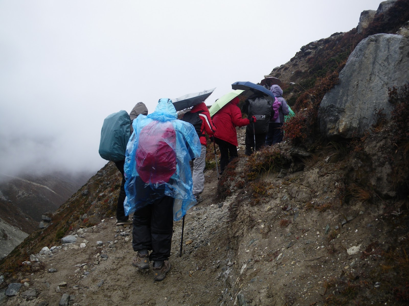
After the climb to Kala Patthar, the weather started to cold foggy and rainy.
We were thankful that we have already made our climbs, and glad that it did rain at the beginning of our climb.

We broke camp, and start our descend to Lobuche.  From this moment onward, it was downslope and more oxygen.

As can be seen, there were still snow on the ground, and getting very misty and cold.
Heading back to Lobuche, and Ama Dablam peak will be the direction of our heading, if only the veil of mist was lifted.
In front of us, were the memorial tablets dedicated to the fallen souls that have or were attempting the summit.
Yea... We can see Ama Dablam!
For us, especially the 5 of us, we were tired but exhilarated.  But at his moment most of us were not in talking mood.  Simply tired, and our objective was to go as low as possible.  Praying that the weather will clear.  It has been wet and cold.

Day 10 –Lobuche to Devoche (3,780 m)
On this day, we descended more than a kilometre!
We entered into Pheriche, the place with the medical centre and one of our team mate has to consult the doctor there due to bad cough.
We were there for lunch, and then we pushed on to Devoche.  Pheriche was simply too windy, and still at 4,200m, may not be the wiser decision for somebody with bad cough!


It had started to rain, and our main camera have to be kept.

Wind was strong, notice the inverted umbrella.  We told this team mate to put on the poncho, and throw away the umbrella.
Though wet, this autumn scenery was much appreciated by us.

Little house on the 'Prairie".
We arrived at Devoche at the last light.  Tired but happy.  It has been raining the whole journey.  Finally, when we retired to our tent, we also realised that our bags were wet.  Thankfully, our waterproofing held, otherwise we will be most miserable.

Day 11 – Devoche to Namche Bazar
As one of our member was stricken with bad cough, we have to keep getting to low altitude to minimize altitude sickness, and to speed up recovery, as temperature will not be as cold as at higher altitude.
Still it was cold!

This morning, as we broke camp.  A musk deer came to visit us.  Alas, the fog was there, and the picture taken was not very clear. Still you can see the teeth that jutted out of its mouth which is very characteristics of the musk deer.  (Scroll down to the bottom to have a look).


It must have not been that cold, for the there are still green on this tree.

Typical 4 footed transport beside the 2 legged kind.
From Devoche to Namche, we will pass Tengboche again. Here we saw this artist painting through his artistic vision of the mountain, for where we stand, the mountain was veiled with fog, but his picture was nice!


The Entrance to Tengboche, is also our exit to Namche.

If we could carry such load!  From our guide in Blue, he was telling us that 25 kg per load is nothing to them, and we struggled with 10 kg!


The Yak Express.  There are no roads, and all goods (unless it is taken from the mountain) are carried on the back of yaks, horses and human!


We had lunch at this lodge, typical of the houses, a cloth curtain hangs at the doorway. 
Day 12 – Namche Bazar to Phakding
From Namche Bazar, it was back to our favourite place at Phakding.
A grand river flows through here, and temperature was nice and cooling.

We were much re-charged in our strength, and the journey back was filled with songs, dance and jokes.  And along the way, we were met with the same beautiful charms of the local as well as the beautiful scenery to match.

One of the many waterfall along the trail.  A lodge is located here, and we have our "umplanned" lunch.  Normally, the cooks and his assistants will be ahead of us, somehow due to communication breakdown, the equipment and cooks were way way ahead at Phakding, and since it was lunch time, we have no choice but to eat here.  Actually, not a bad mistake!

A local harvesting harvested potatoes.  As Winter is approaching, the potatoes have already been harvested, but since there is no proper silo or fridge, the potatoes are placed back in the soil, these will not bud till spring, and can be kept fresh.

Another Grand View as we headed towards Phakding


On this hill side, there are many carvings (properly of prayer chants).  This is very near to the Checkpoint for climbing.


Day 13 – Phakding to Lukla
And the dreaded 220 m of up climb becomes reality!  When we first started our climb on Day 1, we were conscious of the 200 m drop in our ascend to EBC, today was that day that we have to climb that 200m back to Lukla.  Still with heart enlightened as we reached the end of our journey, this 200 m plus climb was nothing in comparison with what we have already done.

Back to our favourite lodge, we just cannot fathom that it was only a short moment ago, we were here eager to go to EBC!

Our campsite at Phakding
Again the mountain greeted us on the following morning as we departed for Lukla


Lukla at last.  The final destination.  We have done it!!!


Our last day sleeping in tent on the high mountain.
Having lived in tent and in closed proximity with one another, a special bond will develop.
Seeing each other strength and weakness, and complementing one another during this period, can only build the camaraderie for the next climb.
There is no strong or weak members in the team, for the team members foster one another, and thus through this, can climbing be more enjoyable and provide the greatest satisfaction!

I love the Mountain.
Day 14 – Lukla to Kathmandu
As mentioned earlier, this is one of the most extreme airport due to the foggy weather condition.  We have arrived at the airport hoping to catch our flight to Kathmandu, but flight was delayed from Kathmandu as it was foggy.  After that it was another delay because Lukla was foggy.  In all, we waited almost 4 hours for weather to clear, before we could catch our flight back.

Flora, Fauna, Birds and Mammal of Himalaya
In fact most of the IDs are unknown to me.  But at such high altitude, the UV light is very strong, thus making the colour of the plants to be very vibrant.

(Pictures by Rainbow Chen)
(Pictures by Rainbow Chen.  Pollination by bee)
(Pictures by Rainbow Chen)
At higher altitude, when the angiosperm ceases the Lichen reigns.

(Pictures by Rainbow Chen)
Lichen covered rocks
Musk Deer - hunted for its musk to be made into perfume!  This Musk Deer visited us in the morning in Devoche just as we have just broke camp to start our journey to Phakding..
Sparrow like bird taken at Gorak Shep (5,100m)
Ravens taken at Gorak Shep (5,100 m)

Acknowledgement
Thanks to Rainbow and James for allowing me to use their pictures.