It has been a while since we last came to Nepal to climb. To be exact, 4 years ago, and that was pre-covid time, when we should be going to Gokyo but plagued with bad weather, we were not able to fly to Lukla, and instead ended up going to Langtang.
(https://mountain-n-sea.blogspot.com/2019/10/langtang-national-park-tserko-ri.html)
This time,
we were successful in going to Gokyo, for the weather was “apparently” fine,
and flight was taking off to and from Kathmandu. We, 17 of us, and mostly past mid-50s with a
good number past 60s, have been waiting for this occasion after 4 years of
rest.
But why Gokyo!
It can be considered as the highest fresh water lakes in the world, and because of the altitude, and almost zero human contaminants from fertilizer, these lakes are deemed as oligotrophic, meaning that it lacks nutrients, and thus the water is pristine in purity and clarity. Thus, in these turquoise coloured water filled lakes, at the calmest of time when there is no wind to cause ripple in the lakes, and when the light from the sun is just right, the beauty of the mountains reflects clearly on the water, one can just marvel at such scenes. No words can describe, and even pictures will not do justice to the beauty before oneself. And better still, when the weather is good, the majestic Sagarmartha (Mt Everest) can be seen. Sadly, not for our trip, Mt Everest would be illusive in appearance throughout this trip.
Secondly, Gokyo
is under 5,000 m, and should be doable for most of us. And if one wants to breach the 5,000 m mark,
there is always the Gokyo Ri, at about 5,357 m.
Again, doable with an early morning climb.
Thirdly,
Gokyo is a little village, and there is not much of a crowd during the
beginning of the climbing season, and literally, one can have those lakes to
oneself. Solo and even group pictures,
rarely photo-bombed by unsuspecting intruder.
In contrast, a rare opportunity if one chooses to go to the more sough
after route like EBC.
Having climbed in Nepal the past 4 times, we were familiar with the requirements for acclimatization and we jointly planned the route with our service provider. And here, I would like to emphasis that a good service provider though cost more, is very important, especially, when one encounters an emergency. And on this trek, we did encountered a few emergencies which we managed to deal with them together with the service provider, who has operation staff in strategic locations of Nepal, as well as back in Singapore.
Prior to
this climb which started at end September 2023, we have already heard about
cases of death related to Altitude Sickness both in Nepal and one attempting
Kilimanjaro. Thus, for precaution, in this
group, it was mandatory to take SpO2 reading, 3x a day, during breakfast, lunch
and dinner to ensure that those with onset of mountain sickness can quickly be dealt with, and evacuate if necessary, importantly without the loss of lives.
According
to medical advice, the SpO2 should not go below 70%, and at those altitude,
generally, most of us would be registering between 85% to 90%. Thus, taking
reading 3x a day, and monitoring the trend is very important! We were glad that we took this precaution for
this trek!
On hind-sight, being past mid-60, would have considered Gokyo to be attempted we one is still in the prime of age, and not past those ages, for the trek to Gokyo is full of up and down. This is unlike the EBC and Langtang treks, which we have done previously, tends to be more consistently ascending when moving towards the goal, and descending when returning.
Day 1 - Kathmandu flew to Lukla then trekked to
Phakding
From October 2023, domestic flight to Lukla will be moved to Ramecchap, about 130 km away
from Kathmandu, but 4 hrs on the road due to the mountainous path and
traffic. As we crossed October on our
return leg, we will land in Ramecchap, and returned to Kathmandu via this arduous 4 hrs drive route.
As usual,
landing in Lukla is very exciting, akin to landing on aircraft carrier albeit a
stationary one. For the length of the
runway is about 400 m, and sloping upward so as to use gravity to assist in
slowing down when landing, and speeding up when taking off. And, for this airport located on a cliff,
weather is always an influencing factor for its operation, as this airport has
seen many clashes for both fixed wings and helicopters. A simple search on Google about this airport
will yield many unfortunate accidents.
For
example,
https://simpleflying.com/a-look-at-lukla-airports-accident-ridden-history/
Having landed at Lukla, we trek from Lukla to Phakding, this will be an easy walk. In fact, descending trek of 200 m to Phakding. Though at 2,600 m, one might not usually associate with mountain sickness, yet we met a Canadian lady who succumbed to mountain sickness, and stay the rest of her trek in Lukla to recover.
Twin Prop landing at Lukla, picture taken after we have landed, and taken over a fence.Upon landing, we immediately proceed to a rest house for tea, and to gear up for the walk to Phakding
The gate signifying the start of our trek! This gate was built in memory of the first lady climber to Mt Everest.
A new addition from previous trips, registration for all climbers entering the Sagarmatha National Park.
But the weather turned unfavourable, and we have to put on our rain gears. And this on/off kind of weather will be experienced by us, throughout this trekking.
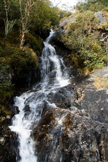
Along the way, we will see many waterfalls and crossed many bridges.
And soon we reached our first lodging place.
Day 2 - Phakding to Namche Bazaar
This morning, the weather looked promising!!
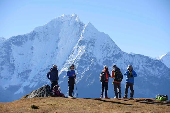
With clear sky, the mountain was gorgeous.
Journey to Namche for us who have gone there before, will be the sight of steps and many more steps. Unending switchbacks as one ascends to Namche. To the first timers, as I once was, it will be “when will the peak be reached” or “not another switchback!”. Regardless, all switchbacks will lead to level ground, and in this case, Namche.
Namche at 3,440 m, would be considered as a good spot for acclimatization, and this was what we did previously. We chose to stay one extra day in Namche, both to acclimatize and to enjoy this village.
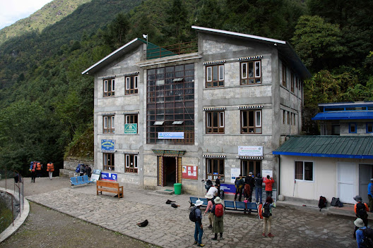
Finally, our resting lodge overlooking the Namche town.
At that point in time, one is simply too tired after all the climbs, though Namche is not considered very high in altitude, to take pictures. But we will back, and hopefully the weather will be kinder and we will be more filled with energy.
Day 3 - Namche Bazaar to Kyangjuma
Namche will
be the cross road for those going EBC and Gokyo. This time, we will take the “left” turn to
Gokyo. The maxim for climbing is “go high, and sleep low”, and we decided to
move to the next location, Kyangjuma, which is slightly higher at 3,600 m, but
will require us to ascend to about 3,800m at Khumjung before descending to
Kyangjuma. This way, it fulfilled our
maxim and will also shorten our trek to half day for the next portion of our
trek. This method, will continue to be
our mode of acclimatize instead of physically staying in one spot to
acclimatize.
At Namche, a must visit is the Sagarmatha National Park, where Tenzing Norgay Sherpa Heritage Cebntre is located. Visiting this place, not only for the history of the first climb to Mt. Everest, but also on a clear day, Mt. Everest can be seen, and there is a spot where nice photo can be taken. Alas, this very day, there was simply too much cloud in the air. Mt Everest was obscured, but still we have nice pictures taken at this place.
A place that we have never visited before, is the “Sagarmatha Next”, a community effort by volunteers to rid the park of litters. Like most popular places, where there is much tourism which bring in the wealth, the tourism industry also generates a lot of wastes. And this organization took the initiative to collect litters in “1 kg bag” which the trekker can bring down the mountain for proper disposal, and other recyclables are turned into work-of-arts or into souvenirs!
In this lodge, Ama Dablam View Lodge and Restaurant, the name shortened to the “Royal Lodge”, for the owner of this lodge has some kind of working relationship with British Royalty. Hung on the lodge walls are many photos of the royalty as well as letters and gifts of commendation.
Day 4 – Kyangjuma to Phortse Thang
Another wet day!
The greatest surprise on this trek was when the National Bird of Nepal decided to fly before us. This colourful bird, the Himalyan Monal (Lophophorus impeljanus) with its myriad of colours supposedly to represent the multi ethnicity of Nepal, simply looks gorgeous.
Having traversed the whole morning, finally we reached Mongla for lunch. The lodge is called Hilltop and is at the peak of a ridge at 3,979 m, and for good reason which we will find out after lunch.
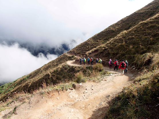
It will be a long never-ending switchbacks of descends which we know, when there is down, there will be up on the return leg! Seriously, not looking forward to the return leg, for by then, we probably will be exhausted!

From the Hilltop and descending, one would be able to see Tengboche on the opposite ridge, which has the trail leading to EBC.
Day 5 –
Phortse Thang to Machermo
Once again,
a wet day.
But we were nearer to Gokyo! Along the way, the sun peeked out from the cloud and bathed our trek with light plus warmth. And we were fortunate to see a rainbow beneath us at the valley!

And finally, into Machermo.
Day 6 –
Machhermo to Gokyo
As is the
weather of yesterday, again wet.
Rain gear
and protective garments. For at this
altitude, warmth is critical, and avoidance of getting wet is critical. Walking in wet clothing is simply miserable!
Due to the
drizzle, few photos were taken on this going trek.
As usual,
we attempted to climb high and sleep low, though we have already reached Gokyo,
many of us attempted to climb further, along the same trek as leading to
Gokyo-Ri. The team managed almost to
5,000 m before turning back as the weather was turning adverse, and definitely
not ideal to be caught up in an open spot on the mountain.
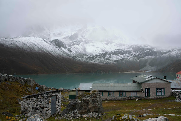
But during the calm before the storm, managed to get some nice shots of the 3rd lake without ripple, mirroring the mountains on the water.
Day 7 – Gokyo to Machhermo less the Ri!
This day
would have started early for some of us who have wished to attempt the Gokyo-Ri
summit. Alas, in the previous night, we
encountered certain medical emergency, that requires helicopter evacuation, and
many spent the night coordinating the rescue mission which led to the general
consensus to abandon the summit climb.
Though a
disappointment to some of us who have wished to summit, yet again the team
spirit prevailed. That the members
should be together, and not splintered into 3 groups, those summitting, those
not summiting and those evacuating.
Coordination among the 3 groups will become very resource intensive,
especially when network is not readily available.
Thus, in
any climb, it is always good to travel with likeminded trekkers, who will stick
to thick and thin. This may not be true
if there are different groups joining a common service provider, then the
interest of the different groups may yield undesirable results.
Morning in
Gokyo was a glorious morning, sun shining ever so brightly.
What we were not able to capture the day before, now will be done in earnest with many photo shoots. But still our hearts were heavy, for the team is not complete, seeing that we have heli-evacuate 5 of our team members. We prayed for their speedy recovery, and continue to be in touch with them, whenever network was favourable.
Day 8 –
Machhermo to Kyangjuma (the Royal Lodge)
Next day at
Machermo, a cold but sunny morning we will set off for lower altitude.
And today will be the day we have to climb the various unending switchbacks to the Hilltop. This time, the weight of the camera gears overwhelmed me, and decided to pass my camera gears to the assistant guide. A wise decision, for this guide was very fit and has no problem with such a “heavy” camera, and he was allowed free liberty to photo at will.
Should have
asked him to do so on Day 1!
After the
Hilltop, it will be an easy descend to the Royal Lodge.
Day 9 – Kyangjuma to Phakding
A sunny
day, lower altitude, the walk to Khumjung should be easy.
But to Khumjung would required us to pass Namche, and there will be the many switchbacks down. Going up maybe tough, But going down, is also just as tough.
When we were trekking to Namze from Phakding, we have to detour as one part of the trek has been destroyed by landslide, and we have traversed across new soft and muddy trail. This was forgotten until we reached the same detour on our way to Phakding.
Being a new trail, there was little footholds and solid areas to plant one's foot. This is the part that we have to travel slowly and carefully, for we do not want to risk injury at such a time and point of trekking.
Day 10 –
Phakding to Lukla
Finally,
the last day. A short walk of about 3
hours of mostly uphill. But morale was
high, though a 200 m ascend, somehow of us still manage to run to reach the
destination.
Today, Lukla was a happy destination. It means we have make it to Gokyo and back, and soon we will be in Kathmandu.
Sadly, this was not the case. When we reached the lodging in Lukla, we were told that Lukla Airport has been closed for 4 days. No flight in nor out!
Basically, we were stranded!!
In our
planning, we have planned such a contingency, and that is we have added a day
of buffer for such an event as this! But
even this buffer was eaten up, for all of us have to fly out by helicopters,
and there were many stranded trekkers who were in the same plight as us. Basically, we were in dire situation, how to
fly out from Lukla.
As reported
in the local news, Lukla airport has been closed for many days and causing
great inconvenience to both inbound and outbound travellers.
https://thehimalayantimes.com/nepal/tourists-seek-alternatives-as-bad-weather-disrupts-air-travel
Day 11 –
Lukla to Surkey to Ramecchap and then to Kathmandu
After much
disappointment, with our luggage at Lukla Airport, the decision was made to
have 5 of us descending to Surkey, the nearest helipad, where we hope to catch
any available flight out to Ramecchap.
We have been waiting since 6 am, and the decision to make the journey
was make at about noon, thankfully, we managed to get a helicopter ride out at about 3:30 pm to Ramecchap, and from Ramecchap to Kathmandu, arriving closed to 9 pm.
Day 12 - Lukla to Surkey to Ramecchap and then to Kathmandu
The
remainder of 7s was at the airport at 6 am, and seemingly optimistic for the luggage
were all checked in, only to be told once again, the airport was still closed,
and no helicopter service will be available.
This time, the decision was to have all 7s made their way to Surkey and
hope to catch any available flight out to Ramecchap.
Alas, only
5 seats were available, and we have to leave behind 2 of our members, who have
graciously and sacrificially chosen to stay behind.
Day 13 - Surkey to Ramecchap and then to Kathmandu then to Airport
Today will
be the day we returned home. But, our two
members only managed to catch a ride out from Surkey in the early afternoon,
and only managed to reach the airport when the gate to our flight closed!
Thankfully,
alternative flight was found for the journey home!!
Epilogue
Though we
are all safe and sound back home, now the nightmare of claiming insurance for
· Flights
cancellation
· Flights
postponement
· Extra cost
incurred during the Airport Closure
Honestly,
not sure how it will proceed, for during such time, there is so much chaos, and
documentation records were not very complete.
What can we
learn from the last few days of our trip?
Frankly, Lukla Airport closure was to be expected, but not over 5 days! And closure to this airport seems a common occurrence, that the authority should have considered alternative routes beside flying into Lukla, especially if this same authority wants to have repeat travellers to Nepal. As there are people who, because of this closure did not make it to their trekking destinations, but were stuck in Ramecchap.
Better yet is to consider opening up
non-operational airport eg. in Namche, instead of flying into Lukla. Unless, the authority would like to maintain the dubious reputation of Lukla Airpoirt to be the most dangerous airport in the world!
Secondly,
Ramecchap is not an ideal alternate place for Domestic flight, if the journey
from Kathmandu to Ramecchap takes 4 hours with certain parts of the road
disappearing into muddy tracks. The way to
Ramecchap should be handled first before opening the airport for domestic
flights.
Thirdly, in
all these times of chaos, there was no word or help from the authority
here. Every travellers were for
themselves. But having said these, kudos to the Nepali people and most importantly to our service provider that they went out of their ways to ensure safe passage for all of
us. Without them, we might still be up
in Lukla, using up valuable funds and resources, and wondering what will be
next.
To future
travellers who are making their way to Lukla, consider enough buffer times and cash for
being stuck in Lukla. One may not be
able to control the weather, but one certainly can mitigate this risk of delay.














1 comment:
A thorough, thought-provoking and educational article with a highly enjoyable storyline and well-taken and chosen photographs. High respect to the author!
Post a Comment