In my previous blog, the Snow Mountain was proven elusive as we weather was unfavourable, and the fog was too thick for a safe climb, and our attempt to climb Jade Mountain was foiled by our inability to obtain permit to stay at the PaiYin Lodge (排雲山莊).
http://mountain-n-sea.blogspot.sg/2012_05_01_archive.html
We learnt our lesson, not to attempt to climb in the Taiwanese Mountains in late spring, but to aim for October and November period, where the weather is more favourable. And this time, we climbed in October, and indeed the weather was fantastic!
Jade Mountain (玉山主峰) is the highest peak in Taiwan at 3,952m, and this is followed by Snow Mountain (雪山主峰) at 3,886 m, forming part of the famous 100 peaks (台灣百岳).
And beside these 2 peaks, we managed to climb 3 others peak belonging to this listing.
Snow Mountain
Located in the north of Taiwan, and a relative short drive to the Climbing Entrance (登山口), it will be a much anticipated climb, as we were not able to climb the last time due to foul weather.
Arriving at WuLing, the sky looked threatening, and we were thinking whether it will be another case of partial climb, and to be "washed" out by the weather again.
October and November, we were told are the stable months for climbing, less rain, and the typhoon season would have passed. At the same time, it is also the autumn period, and leaves are turning from green. If weather permit, the autumn scenery will be most wonderful.
With that wish, and anticipation, we started our climbing journey.
Wuling to JiKai Lodge, and then to 369 LodgeThis will be a short walk of about an hour from the entrance to Jikai Lodge where a night will be spent enjoying a night at the mountain. The next day, we would proceed to the 369 Lodge which is quite a distance away. Along the way, we would ascend our first summit, the Snow Mountain Eastern Peak (雪山東峰).
For the season hiker, they will bypass the JiKai Lodge, and aim for the 369 Lodge. And at 2 or 3 in the morning, proceed with the summit climb.
 |
| From this maple tree, though the green still outnumbered the yellow and orange, already it has added enough colour shading to put vibrant to this tree. |
 |
| A butterfly of Black and Red fluttered into our view, though its wings were a bit torn, it was still a beautiful sight. |
 |
| Wild grasses grew in abundance, and the cloud covered peak seems to dash our hope of sunny weather. |
 |
| But onward our journey began, and steps we started to climb. Our guide, a gentleman in his early 50, led us our quest. |
 |
| Our guide is also a botanist, and along the way, we have our botany lesson. Unfortunately, the lesson was in Chinese, and much of the name was lost. |
 |
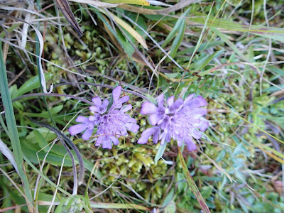
| Many beautiful flowers adorned the path that we walked. Though it was autumn, but the weather was still balmy for the many flowers to bloom. |
 |
| A beautiful lobed leaf of an unknown plant. |
 |
| "Old Man Beard" - a type of moss that only grow at high altitude with clean air and water, that cover this pine tree. |
 |
| Toward 369 Lodge, one will have to pass the "Crying Slope", so name for the steep slope that all will have to traverse, but we eventually found out that when one descend, then the "Crying Slope" name applies. For climbing down this stones strewn pathway, was more difficult than the ascending! |
 |
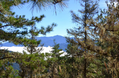
| Along the way, we were bless with beautiful mountainous views. The sky has clear, and occasionally we wish for some cloud covers to shield us from the glare and heat! What an irony! |
 |
| The Eastern Peak - though low, it was a joy in reaching this summit, as it also meant that we are near to our resting place. |
 |
| The 10 of us that reached this summit. |
 |
| Onward we went to our resting spot. |
 |
| Though the tree may be dead, the trunk and weather beaten branches formed a very remarkable shape. |
 |
| 369 Mountain Lodge |
 |
| Every year, the greetings will be different. Refer to my other blog site for 2012 Greetings. |
 |
| When daylight broke, and the clouds forming like a sea, enveloped the mountains, we paused in our climb, to view this majestic sight. |
 |
| We started our summit climb at 2 am, and finaly reach this spot which will be the last 1 km to the summit. Though it looked near, but it will be another 1.5 hr of arduous climb. As can be seen from this picture, the path was filled with loose rocks and stones. |
 |
To the right, I saw a figure in white, and where I was, I wished I was already there.
Telling myself I will be that white spot, with determination I plodded on,
till at last I was that white spot, to be envied by somebody in my original spot! |
 |
| Yea, the 2nd highest mountain summit in Taiwan. |
 |
| The View from the Top. |
 |
| A sparrow at the summit. Unlike in some mountain, where the peak is barren, this peak though covered with gravels is also covered with grass. But comes winter, these will be covered with layer of snow, and thus the name of this mountain. |
 |
| Another intricate pattern of trunks and branches. |
 |
| On the way down, we will pass many of these giants. |
 |
| Retracing our footsteps to the entrance of the trail. |
 |
| It may be midday, but in the forest, it can be dark. |
 |
| I just love the mountain! |
 |
| We were told it was the season of the "White Pearl" Fruit. We found them in abundance, and this berry was refreshing to the taste. |
 |
| Close up of the fruits. A type of berry, and the ripen fruits were white. |
 |
| A study in Blue! the layer of mountains and ranges seem to overlap one another. |

|
|
More intricate shape of the tree, and only possible on a mountain with howling wind, and merciless snow and storm, shaped this masterpiece! |
 |
| A tree that demonstrate the colours of Autumn. |
Jade Mountain (玉山)
The highest mountain in Taiwan, and also the most popular.
Previously, we have tried applying for the permit to stay at the PaiYin Lodge, but was not successful, and similarly to previous attempt, we were again not successful. Thus, we were left with one option, and that was to ascend and descend within the same day.
The criteria we were told, was to reach the PaiYin Lodge by noon, or we will have to turn back!
Not dissuaded, we decided to start our climb at 3 am from the DongPu Lodge.
At that hour, it was an additional of 2.8 km trekking from this lodge to the Entrance point, and that will be an hour of effort.
Unlike XueShan, to the local seasonal hikers, we were told that Yu Shan will be easier, for the path are wider, and much easier to trod.
For us, that was true, except the last half kilometre where we have to scale the rock face with the chain that have been provided, that part it was scary.
 |
| DongPu Lodge |
 |
| The starting point of our climb from the lodge. |
 |
| In the wee hour , we set forth on this 2.8 km track. |
 |
| Signage of the YuShan Mountain Range. |
In the treks, we will cover 86 of such bridges, and each of them marked from 1 to 86.
 |
| Every of such wooden bridge will be marked with this tag. This is number 86, the last of the bridge , and after which will be the climb to the summit. |

 |
| Sign pointing to the different summit. |
 |
| One of the friendly bird, conditioned by the human traffic, waits at the resting point from food waste and careless discard. |
 |
| The path becomes narrower, the nearer to the summit we reached. Barely 2 feet across, we have to walk with caution. |
 |
| Due to the extensive rock falls, a covered walkway was built to protect climbers. |
 |
| The precarious last half a kilometre, would see us climbing with aid from the metal chains. |
 |
| And finally we reached the summit. As can be seen from the outcrops, this summit is very unlike the XueShan peak which is more of a flat peak. |
 |
| Cornerstone of YuShan |
 |
| A research observatory, unfortunately on this same day, a helicopter carrying researcher crashed. killing both crew and the lone researcher. |
 |
| On the way down, we looked up, and saw where we have descended! |
 |
| Finally after 13 hours of trekking, we are back to the starting point. |


